SBR Comprehensive Traffic Engineering Services, Statewide, Maryland

Freeway Incident Transportation Management (FITM) Plan Development

T3 was responsible for developing FITM plans for various MDTA facilities. Under this task, continued work on the Authority’s program to prepare emergency response plans that can be used as off-the-shelf plans when roadway closures are required. T3 conducted site visits to collect existing conditions and to identify primary and secondary detour routes for corridors in Baltimore.

For each roadway closure point, T3 looked at potential detour routes for the preceding exit to the next following freeway exit point. They prepared GIS maps for the detour routes identifying truck restrictions, vehicle height limitations, fire and hospital routes, critical signalized intersections, ramp closures, and locations of DMS signs along each route. They developed lane closure maps for each interchange, and prepared detailed detour route directions with signing. They also prepared DMS sign message sets to be deployed during detour conditions to inform the driving public.

Triennial Traffic Data Collection Program

This task involved engineering services to provide Traffic Data Collection services along John F. Kennedy Memorial Highway (JFK) and Electronic Toll Lanes (ETL) (I-95), and the Thomas Jefferson Highway (US 40).

A second individual traffic data collection program assignment involved MD 695 (Baltimore Beltway/Francis Scott Key Bridge), US 301 (Crain Highway/Harry W. Nice Bridge), US 50 (Blue Star Memorial Highway/Bay Bridge) and MD 200 (Intercounty Connector).

T3 was responsible for providing traffic data collection at about 100 mainline and ramp locations, as well as 25 intersections, processing and balancing the data, and developing volume diagrams for each facility.

The scope of work was itemized as follows:

  • Perform 7-day classification counts using FHWA 13-vehicle classification categories along mainlines and at entrance and exit ramp roadways

  • Perform 48-hour volume and classification counts on bridges

  • Collect 13-hour turning movement counts (TMC) at intersection locations, with itemized u-turn and pedestrian movement counts

  • Develop Traffic Volume Diagrams to illustrate compiled data with network line diagrams using MicroStation

  • Prepare final spreadsheet deliverables of all count data in SHA-HISD format

Miscellaneous Traffic Design and Analysis Services

This open-ended task included traffic engineering services in support of the various MDTA projects and initiatives on an as-needed basis:

  • Review of project plans, shop drawings and MOT plans for individual work assignments

  • Development of traffic design and maintenance of traffic plans

    • Conduct field reviews and investigation of all MDTA facilities to identify improvement requirements

    • Develop plans for signing, maintenance of traffic, lighting, signals, and ITS

    • Develop cost estimates and specifications

    • Coordinate field changes and construction phase services

  • Traffic analysis support

Review of Traffic Design and Analyses

This task involved engineering services to review various project plans and analyses submitted to the Authority by others:

  • Maintenance of Traffic (MOT) plans

  • Pavement marking and signing plans

  • Transportation Management Plans (TMP)

  • Engineering cost estimates

  • Detour plans

  • Traffic impact studies

  • Attend review meetings as needed to further explain and/or address any comments provided by T3.

On-Site Staff Augmentation

T3 has overseen on-site support tasks using subconsultants to cover shorter-term staffing losses by MDTA for periods up to eight months at a time. Consultant personnel provided traffic engineering expertise and administrative oversight on an as-needed schedule of three to five days per week, coving multiple staff positions of varying experience levels.

Quadrant Roadway Intersection (QRI) – Route 340/522 and Route 55

Back to Operations Services

Project Name: Quadrant Roadway Intersection (QRI) – Route 340/522 and Route 55

Project Location: Town of Front Royal, in Warren County, Virginia

Client: VDOT

Description of Project:

This project involves the first Quadrant Roadway Intersection (QRI) in Virginia. A QRI is an innovative intersection design that is intended as a cost-effective solution in congested areas. This location is the intersection of two busy roadways. The new QRI reroutes all four left-turn movements away from the intersection and onto a new road connecting the two intersecting roadways. The benefit of this design is that it eliminates all left turns at the main intersection for greater safety and less overall delay.

T3’s Role:

T3 was responsible for developing new signal timing plans for the QRI. They also used VISSIM traffic simulation software to create animated videos to be shown at the VDOT Public Hearing so that citizens could visualize how the new QRI would work. These videos illustrated the unique travel paths associated with the Quadrant Roadway Intersection (QRI).

To make the simulations realistic and readily understood by those familiar with the area, T3 developed area-specific 3D landmarks in the vicinity of the QRI using SketchUp software and embedded the customized 3D objects in the VISSIM simulation. T3 also included a bird’s eye view window with a moving object on an aerial map to help the viewer locate where the camera was in comparison to the driver viewing perspective.

T3 supported the VDOT public hearing held on September 28, 2017 in Front Royal, Virginia.

Related links:

Eastbound Route 55 to Northbound US Route 340: https://youtu.be/skJqf5irAX4

Eastbound Route 55 to Southbound US Route 340: https://youtu.be/6Nv28RBRmgQ

Northbound US Route 340 to Westbound Route 55: https://youtu.be/hzdCnETDYp0

Southbound US Route 340 to Eastbound Strasburg Rd: https://youtu.be/vriB8a1w1ZM

Westbound Route 55 to Southbound US Route 340: https://youtu.be/SERuuezKIyU

Bird’s Eye View of QRI: https://youtu.be/HfVvqymHHjk

http://www.virginiadot.org/projects/staunton/warren_county_8211_qri_quadrant_roadway_intersection_-_route_340-522_and_route_55.asp

Back to Operations Services

North Avenue Signal Timing Optimization

Project Name: North Avenue Signal Timing Optimization

Project Location: North Baltimore, MD

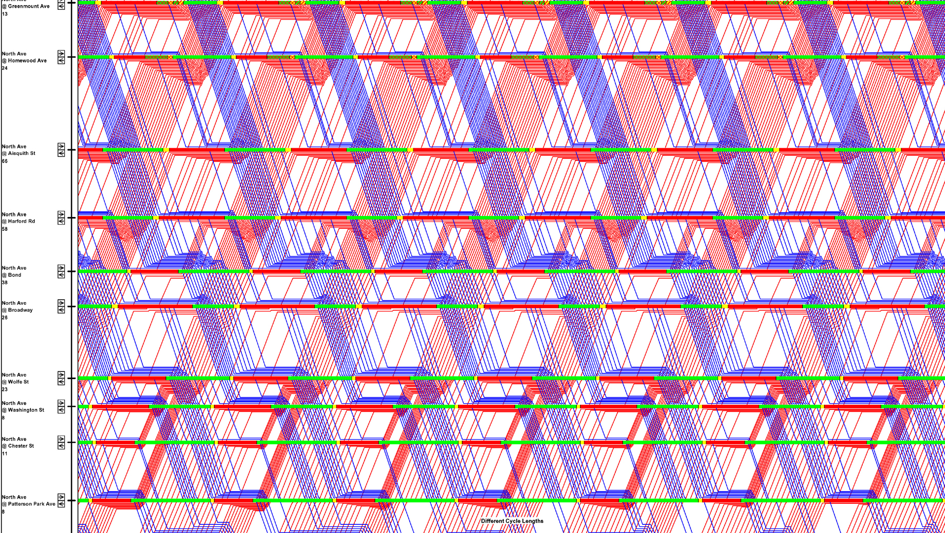
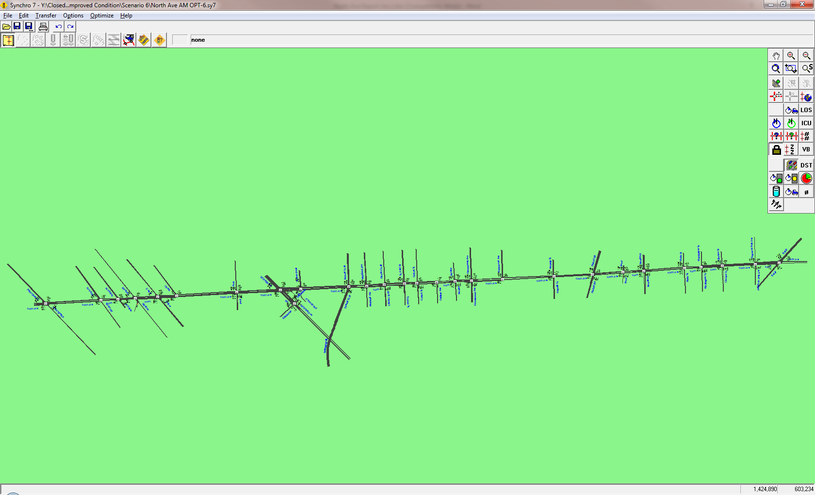
Description of Project: Develop and perform signal timing optimization of North Avenue signal timing optimization performed along North Avenue between Pennsylvania Avenue and Belair Road/Gay Street, composed of twenty-seven signalized intersections on North Avenue, plus an additional signalized intersection south of North Avenue.

T3D’s Role in Project: Conduct comprehensive existing condition data, including but not limited to roadway geometry data, intersection data, traffic volume data, parking information, traffic control, existing signal phasing, and existing pedestrian crossing information. Prepare existing condition for the “before” optimization condition using Synchro signal timing optimization software. Define coordination zones for the signal network and optimize signal timing for the “after” optimization condition. Compare the results between the “before” and “after” conditions data, and summarizes the benefits of optimizing and coordinating signal timing. Benefits are measured in terms of travel time savings, reduction in vehicle operating costs (measured in stops per vehicle), fuel consumption savings, and emissions reductions.

Back to Operations Services

Duke Street Congestion Mitigation Project

Project Location: Alexandria, VA

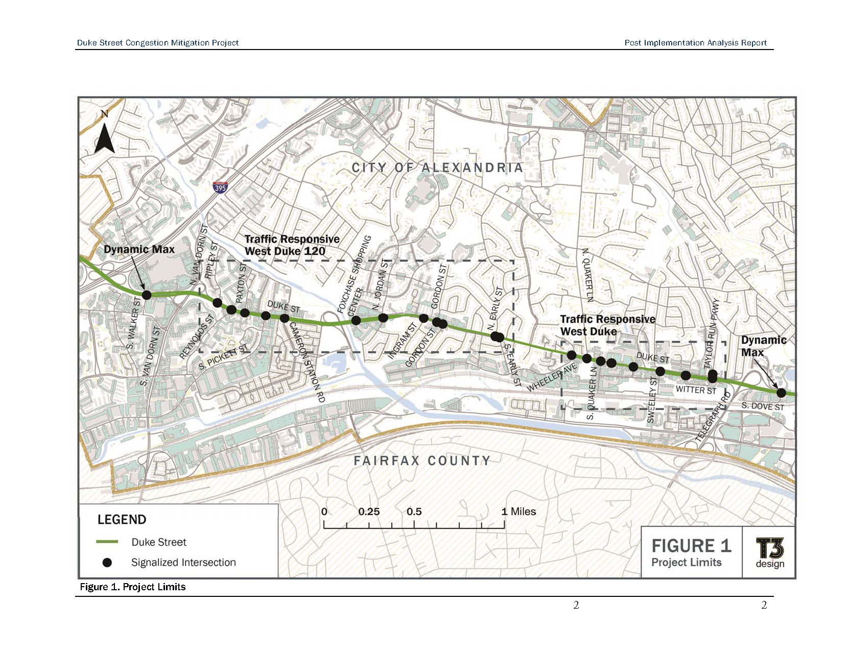
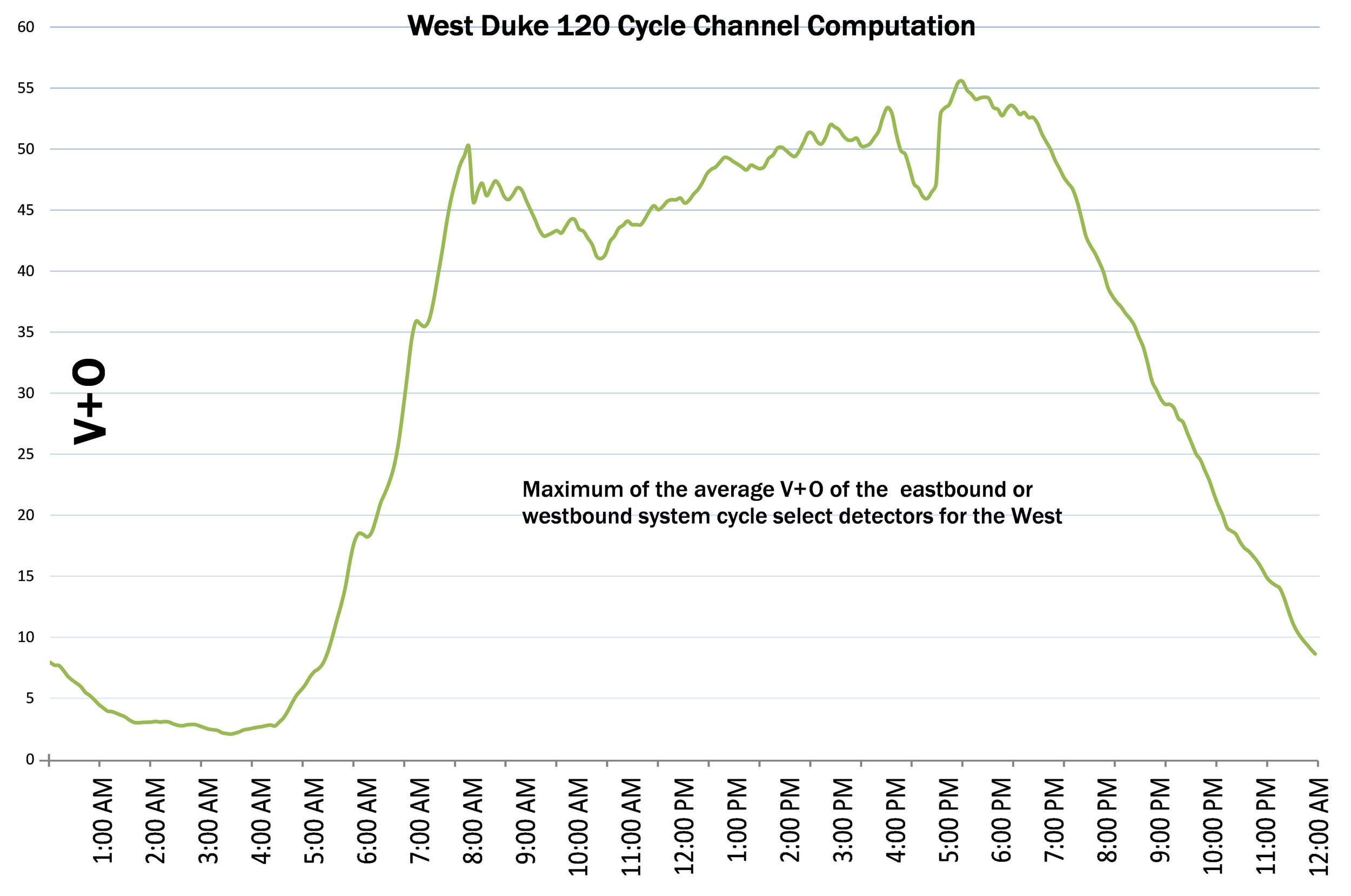
Description of Project: is to relieve traffic congestion along the Duke Street corridor from South Walker Street to the west and Dove Street to the east by implementing traffic responsive signal controls with optimized coordination timing plans, installing improved vehicle detection and installing accessible pedestrian signals. The corridor has peak and non-peak period vehicle demands that can be predicted for a typical day, however, the corridor is also impacted by non-recurring occurrences on both I-395and I-95/495, which cannot be predicted. The benefit of traffic responsive control is the ability to implement timing plans based on the non-predicted occurrences.

T3D’s Role in Project: Evaluate the existing traffic signal operations on Duke Street from South Walker Street to Dove Street. Provide recommendations for equipment and technology upgrades. Develop the plans and procurement documents for upgrades to the traffic control system, communications network equipment and infrastructure, system detectors on Duke Street, local intersection operations on Duke Street, and pedestrian operations on Duke Street. Update traffic signal timing plans and enhancing pedestrian operations within the corridor. Develop and implement traffic responsive signal timing operations.

Back to Operations Services

Northern Baltimore Network Signal Timing Optimization

Project Name: Northern Baltimore Network Signal Timing Optimization

Project Location: North Baltimore, MD

Description of Project: Develop and perform signal timing optimization of the north Baltimore network, composed of forty-one signals on 8 segments on the following corridors: Charles Street, Cold Spring Lane, Greenspring Avenue, University Parkway, St. Paul Street, 39th Street, 40th Street, and 41st Street. The goals established for signal timing optimization is to reduce stops and delays by 10%, reduce overall emissions, and reduce travel times.

T3D’s Role in Project: Conduct comprehensive existing condition data, including but not limited to roadway geometry data, intersection data, traffic volume data, parking information, traffic control, existing signal phasing, and existing pedestrian crossing information. Prepare existing condition for the “before” optimization condition using Synchro signal timing optimization software. Define coordination zones for the signal network and optimize signal timing for the “after” optimization condition. Compare the results between the “before” and “after” conditions data, and summarizes the benefits of optimizing and coordinating signal timing.

Back to Operations Services